Cyclone Michaung Satellite images LIVE Tracking when and where the cyclone will hit in india
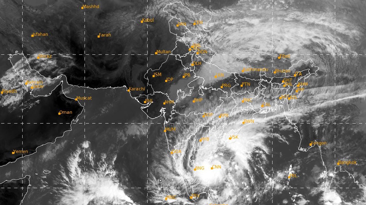
Image from INSAT-3DR satellite (LIVE Tracking) The vastness and intensity of the ‘Michong’ storm can be seen. This satellite is playing an important role in monitoring cyclones. In the images received from satellite, it can be seen that dense spiral bands are visible around the cyclone’s eye wall.
The Indian Meteorological Department (IMD) has expressed the possibility of heavy rain and strong winds in the coastal areas of Tamil Nadu and Andhra Pradesh due to the storm. IMD has warned of very heavy rain in Chennai, Kanchipuram, Chengalpattu and Tiruvallur districts. A red alert for rain has been issued, which means that more than 20 cm of rainfall may occur in many areas.
Government efforts have been intensified to deal with the storm. According to PTI report, NDRF has deployed 21 teams in Tamil Nadu, Andhra Pradesh and Puducherry and has also kept 8 more teams on standby.
Reports received till 3 December showed that the storm was about 250 kilometers east-southeast of Puducherry. It is 230 km south-southeast of Chennai. On Monday i.e. today this storm will reach near the coasts of Andhra Pradesh and Northern Tamil Nadu. The areas where it may hit are being evacuated.